

Navionics HotMaps Platinum Lake Maps – North
$179.99
Navionics HotMaps Platinum Lake Maps – North. Target the best spots and catch more fish!
Description
Navionics Hotmaps Platinum Lake Maps – North – microSD™/SD™
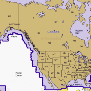
North: Covers IA, MI, MN, WI, ND, SD
All the same lakes content and advanced features found in Navionics+ for GPS plotters are augmented with 3D View, satellite overlay and panoramic photos of marinas, boat ramps and docks. Explore the detail on any lake, whether familiar to you or not, and discover new fishing spots. Includes more than 7,900 lakes.
The Navionics subscription
A one-year subscription to Daily Updates and advanced features is included when you purchase any new product. After a year, you can renew at a discounted price.
Charts & Updates
- Nautical Chart – comprehensive charts derived from multiple official, government and private sources, displayed in a familiar look and feel
- SonarChart™ – innovative 1′ (0.5 m) bathymetry charts created using Navionics proprietary system
- Community Edits – useful local knowledge from edits made by users of the Navionics Boating app
- Daily Updates – More than 2,000 worldwide every day
Advanced Features
- Dock-to-dock Autourouting – start your trip with a suggested route
- SonarChart™ Live – create your own maps
- Advanced Map Options – customize your view
- Plotter Sync – plan on mobile, go on plotter
Additional Viewing Options
- Relief Shading – for an easy-to-interpret, clearer view of bottom structure.
- Satellite Overlay with SonarChart Shading – for an enhanced awareness above and below the water.
- 3D View – to highlight key features
- Panoramic Photos – to get a better sense of your surroundings
Format: SD / MSD
HMPT-N6, HMPT-NORTH
Related products
-
Navionics+ US & Canada
All-in-one max detailed cartography for marine and lakes makes Navionics+ the perfect choice for cruising, fishing and sailing. Format: SD/MSD$179.99 Add to cart -
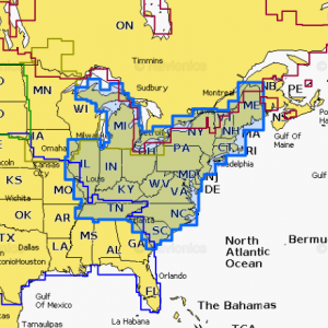
Navionics HotMaps Platinum Lake Maps – South
Navionics HotMaps Platinum Lake Maps - South. Target the best spots and catch more fish!$179.99 Add to cart -
Navionics HotMaps Platinum Lake Maps – East
Navionics HotMaps Platinum Lake Maps - East. Target the best spots and catch more fish!$179.99 Add to cart


Reviews
There are no reviews yet.